


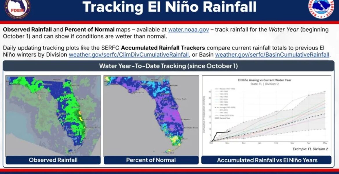
FLORIDA — With a strong El Niño in place, Florida is heading into a winter that could be much wetter than usual. As part of Florida El Niño Awareness Week, the state’s emergency managers and weather officials are highlighting free tools anyone can use to track how much rain is falling. Day 3 of the
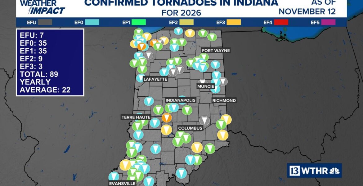
TERRE HAUTE, Indiana — An EF-0 tornado touched down southeast of Terre Haute on Wednesday night November 11 as a line of strong storms swept through west-central Indiana. The tornado was confirmed near the small community of Riley, with maximum winds of 80 mph. It pushes Indiana’s already record-setting tornado count to 89 for the
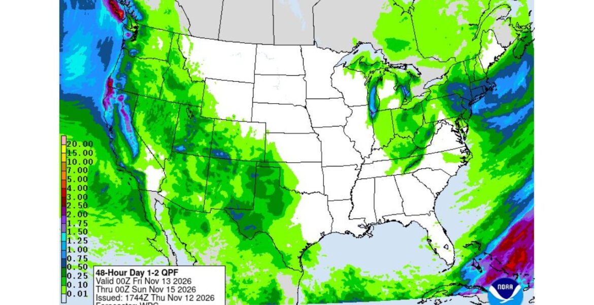
NORTHERN CALIFORNIA — A large atmospheric river made landfall on Thursday November 12, pushing heavy rain into Northern California and the Pacific Northwest. A second storm is lining up right behind it, bringing more rain to the West Coast and a good chance of snow in the Sierra Nevada. Our 48-hour rainfall map, covering Thursday
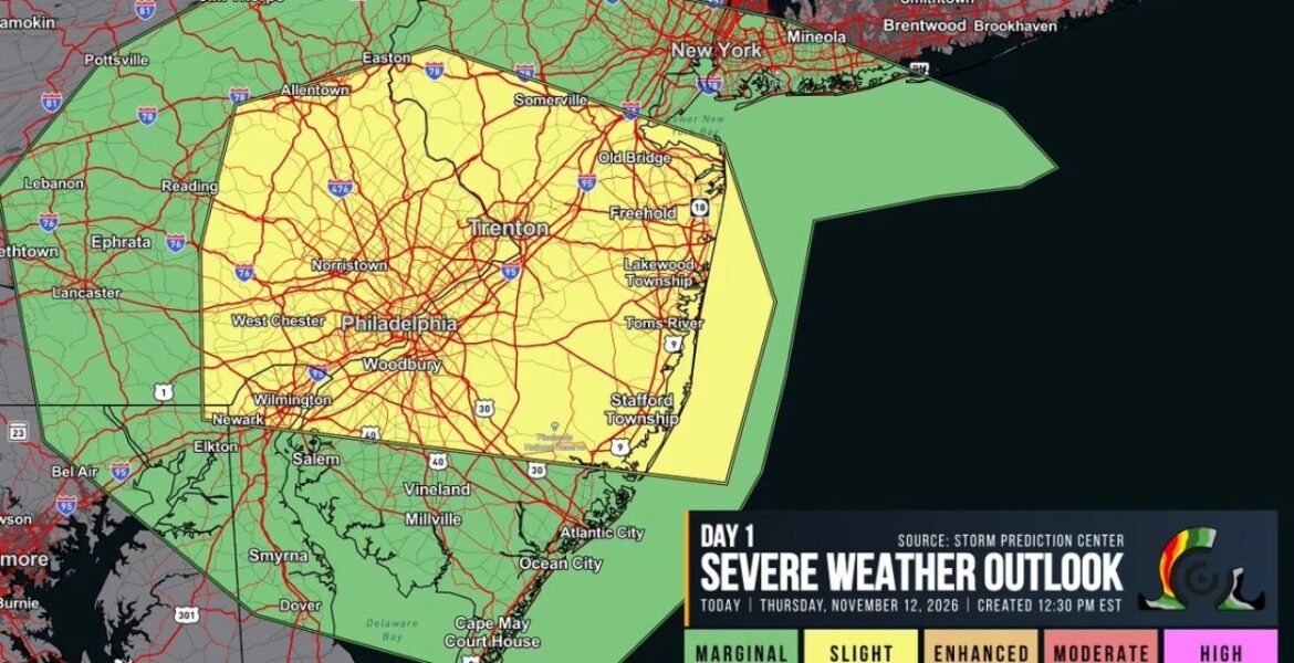
PHILADELPHIA, Pennsylvania — Parts of eastern Pennsylvania and central New Jersey were upgraded to a Slight Risk, Level 2 of 5, for severe weather on Thursday November 12. The outlook, created at 12:30 PM EST, warned that isolated supercells could form along a warm front during the afternoon. Severe hail was the main concern, with
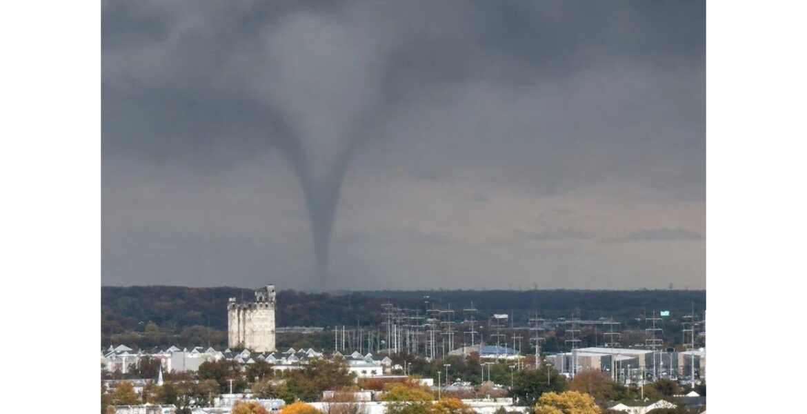
WILMINGTON, Delaware — Dramatic video captured a tornado dropping down just west of Wilmington this week, filmed from inside an office building overlooking the city. Moments later, the storm produced a second touchdown, this time with a fully condensed funnel stretching all the way to the ground east of Wilmington. The rotating storm was moving
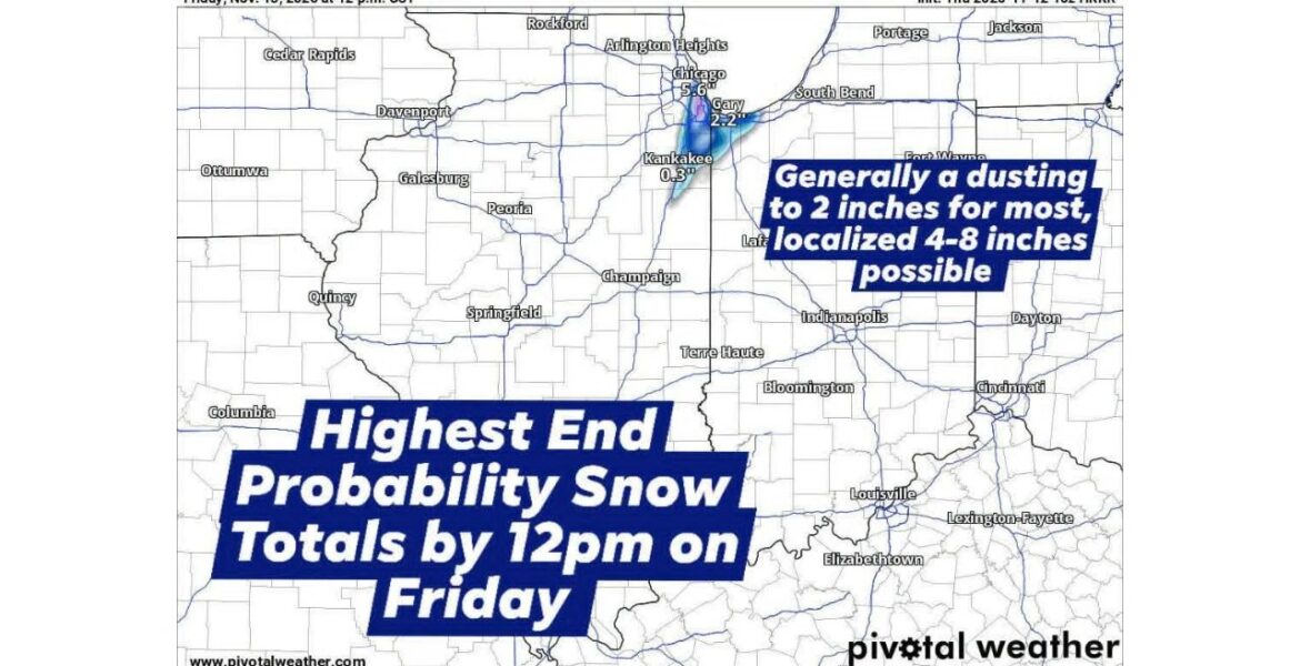
CHICAGO, Illinois — A narrow band of heavy snow has shifted west over the Chicago area, bringing a messy start to Friday November 13. Anyone from Chicago east to Valparaiso, Indiana could be in the path of the band from Thursday night through noon Friday. Most areas are looking at 1 to 3 inches, but
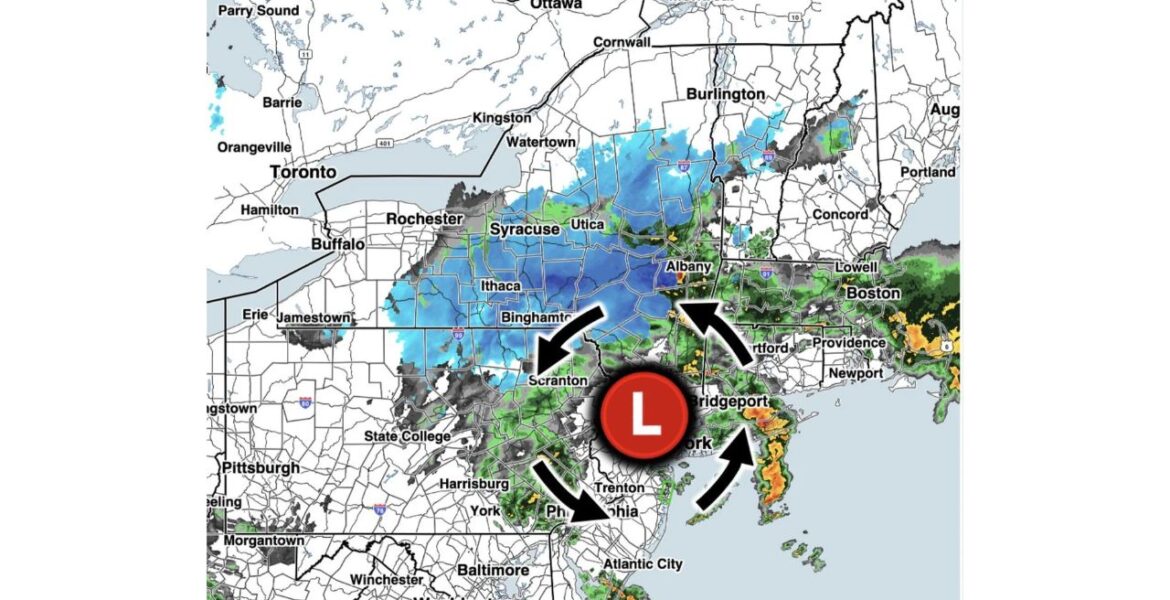
ALBANY, New York — The first snowfall of the season arrived across the Northeast on Thursday evening November 12. Radar at 9:50 PM EST showed snow spreading across upstate New York and northern Pennsylvania on the back side of a strengthening storm. Snowfall rates of 1 inch per hour or more were possible through the
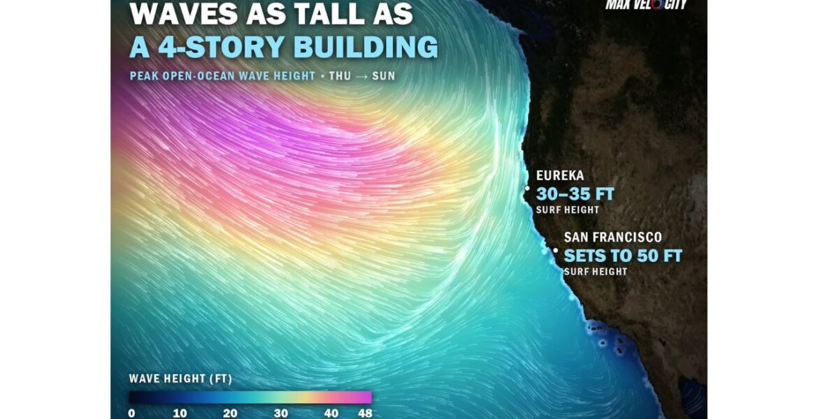
SAN FRANCISCO, California — Waves as tall as a 4-story building are headed for the California coast this weekend. A massive storm with hurricane-force winds out in the North Pacific is churning up seas close to 50 feet, and that energy is racing toward land. Surf could reach 30 to 35 feet on Saturday November
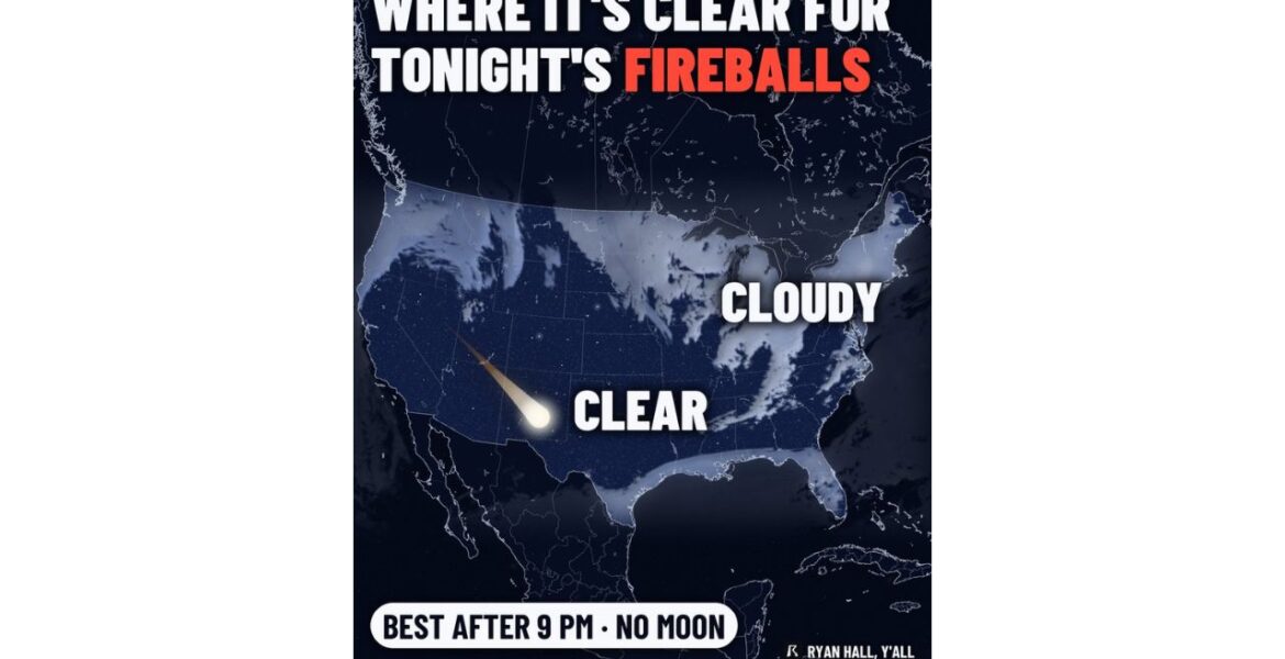
OKLAHOMA — Tonight’s meteor shower may be a small one, but it is famous for something special: big, slow fireballs. The Taurid meteor shower is active on Wednesday night November 11, and viewing is best after 9:00 PM with no moon in the sky. Our cloud forecast shows the Southwest, Oklahoma, most of Texas and
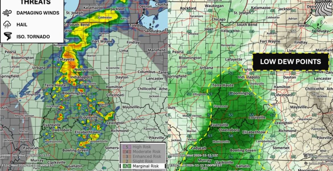
BLOOMINGTON, Indiana — A few strong to severe thunderstorms are expected to fire up across parts of eastern Illinois, Indiana, Kentucky and Tennessee on Wednesday November 11. The area sits under a Marginal Risk, Level 1 of 5, with storms possible after 4:00 to 5:00 PM ET. There is one big factor working against stronger